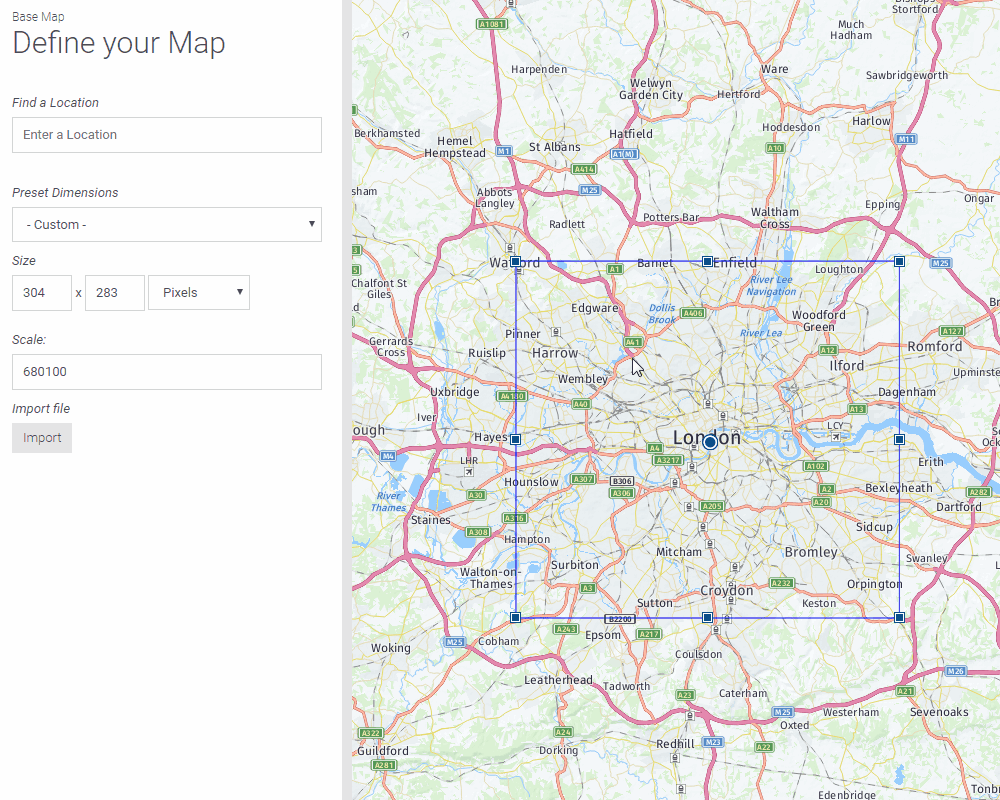
When making your map you need to decide what zoom level your map is going to be. The dynamic maps are zoomable, however, you need to specify the starting point of your map. There are multiple ways changing the scale in your dynamic map.
Method 1:
Enter the scale value in the text box.

Method 2:
Use the box to adjust the scale, you can either keep the same central point or stretch the box from different corners by holding Ctrl button on your keyboard.
Bear in mind that changing these values only influences the initial window of your exported map. The readers can still fully zoom in and out. Do you wish to limit the levels? This works in the last step as follows:
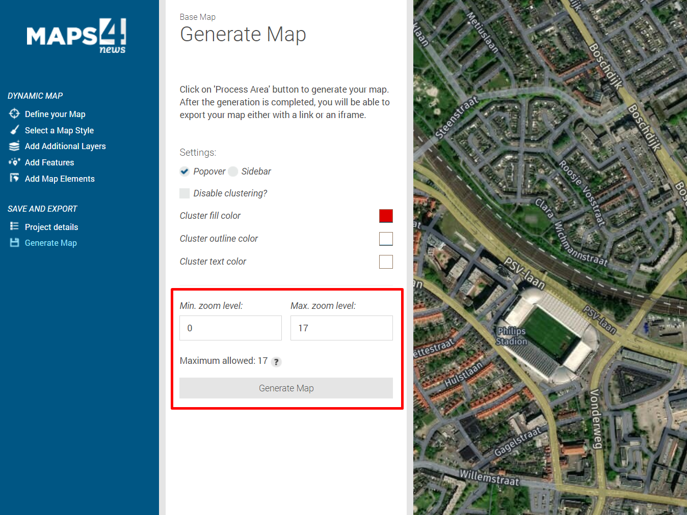
The smaller the minimum, the more the readers can zoom out. The higher the maximum, the closer the readers can zoom into the street level.